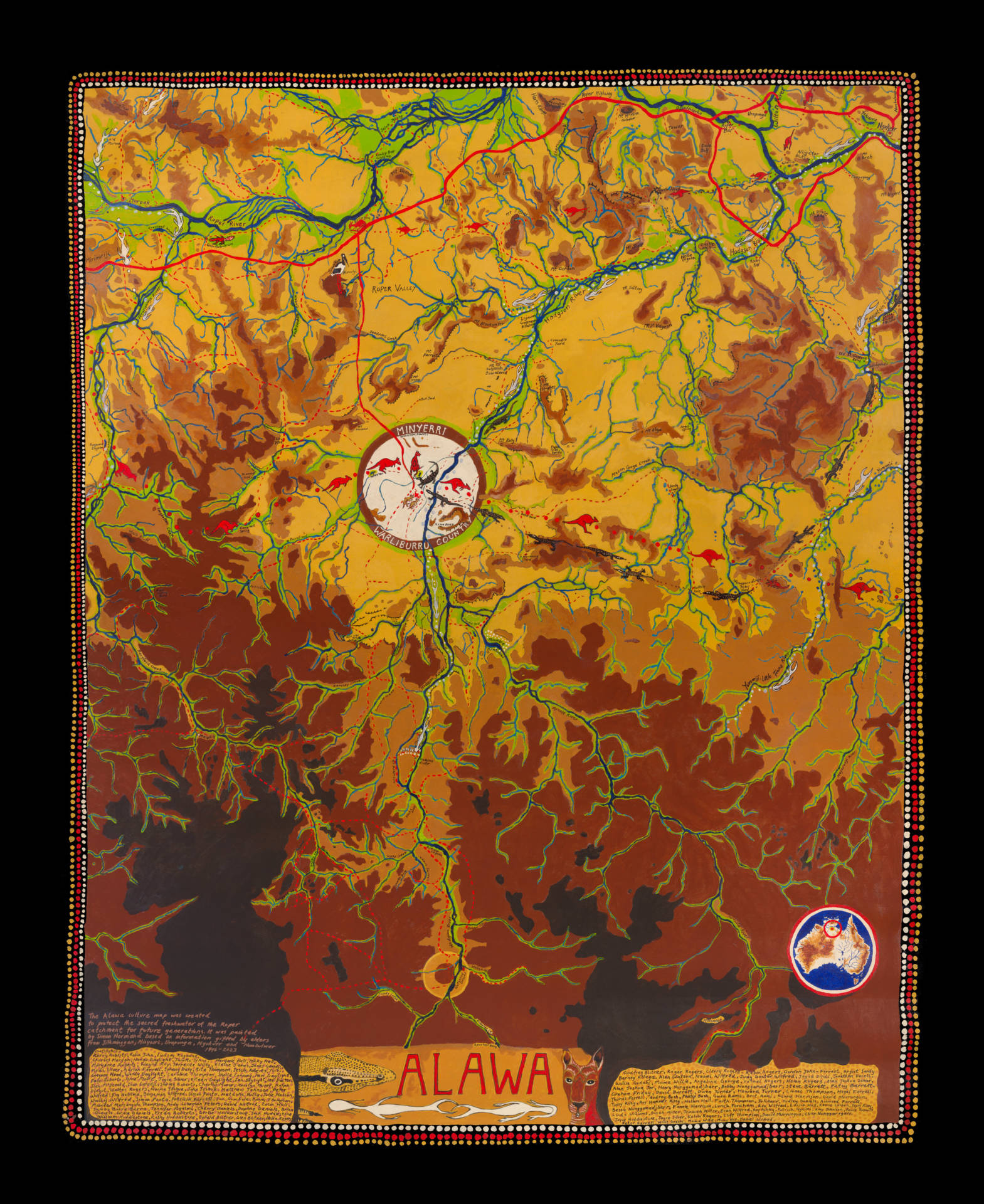
A delegation of Traditional Owners from Arnhem Land have presented parliament with a 13-metre river map petition calling on the federal government to protect their river system from cotton, gas and other industrial projects.
The Roper is the Northern Territory’s second largest river and one of the last free-flowing, tropical rivers.
Hundreds of residents from remote communities along the river are calling for more protection for the river and for the future of their freshwater, which supports the livelihoods of communities and is essential to many sacred sites.
Traditional owners are concerned by proposals to take hundreds of thousands of litres of surface and groundwater from rivers – including the Roper – for industries such as cotton, fracking and mining.
“We’ve got so many important springs to protect,” Alawa Traditional Owner Naomi Wilfred said about her Country near Minyerri.
“We made that map to show Canberra about the water connection. The threat we’re worrying about is cotton is coming in and I think we’ll have no water left. We want to tell them to stop taking water and start listening to the rightful Traditional Owners.
“We want to see this river protected for our future generations.”
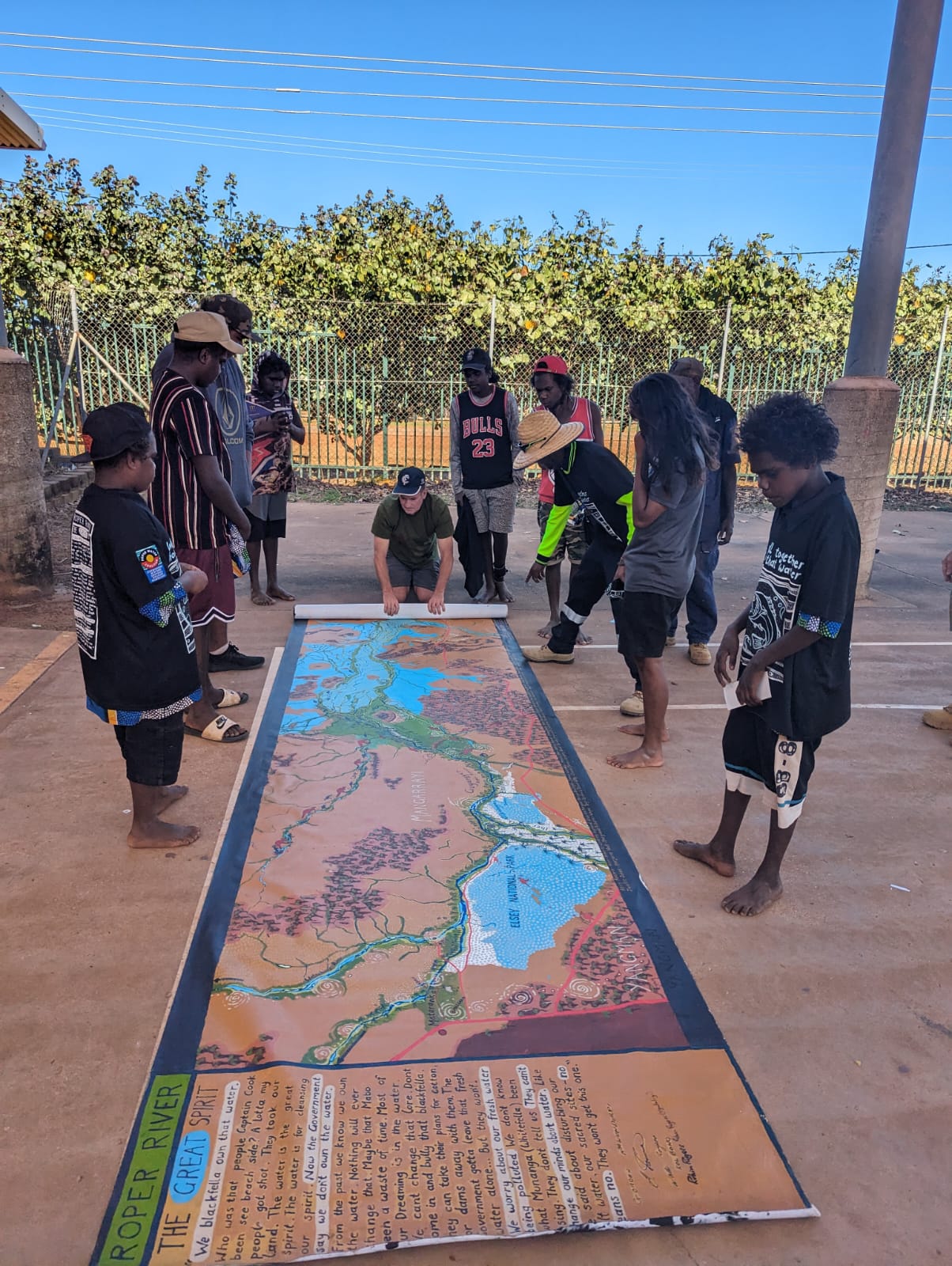
Melbourne-based artist Simon Normand has spent decades mapping oral histories on country in Arnhem Land and travelled through communities.
“This map is an Aboriginal way of showing their world to an outside audience.”
“It is the culmination of 18 months’ collaboration with communities in south-east Arnhem Land, who are extremely worried about their river system being irreversibly destroyed.
“The map draws on more than 25 years of working with elders who want their songlines preserved.”